Multi-Tenant GIS Mapping Platform
GIS Platform · Web App
Multi-Tenant GIS Mapping Platform
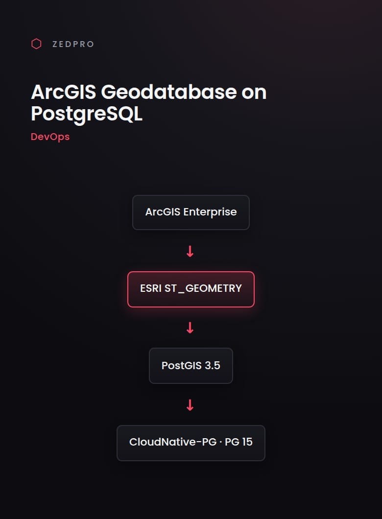
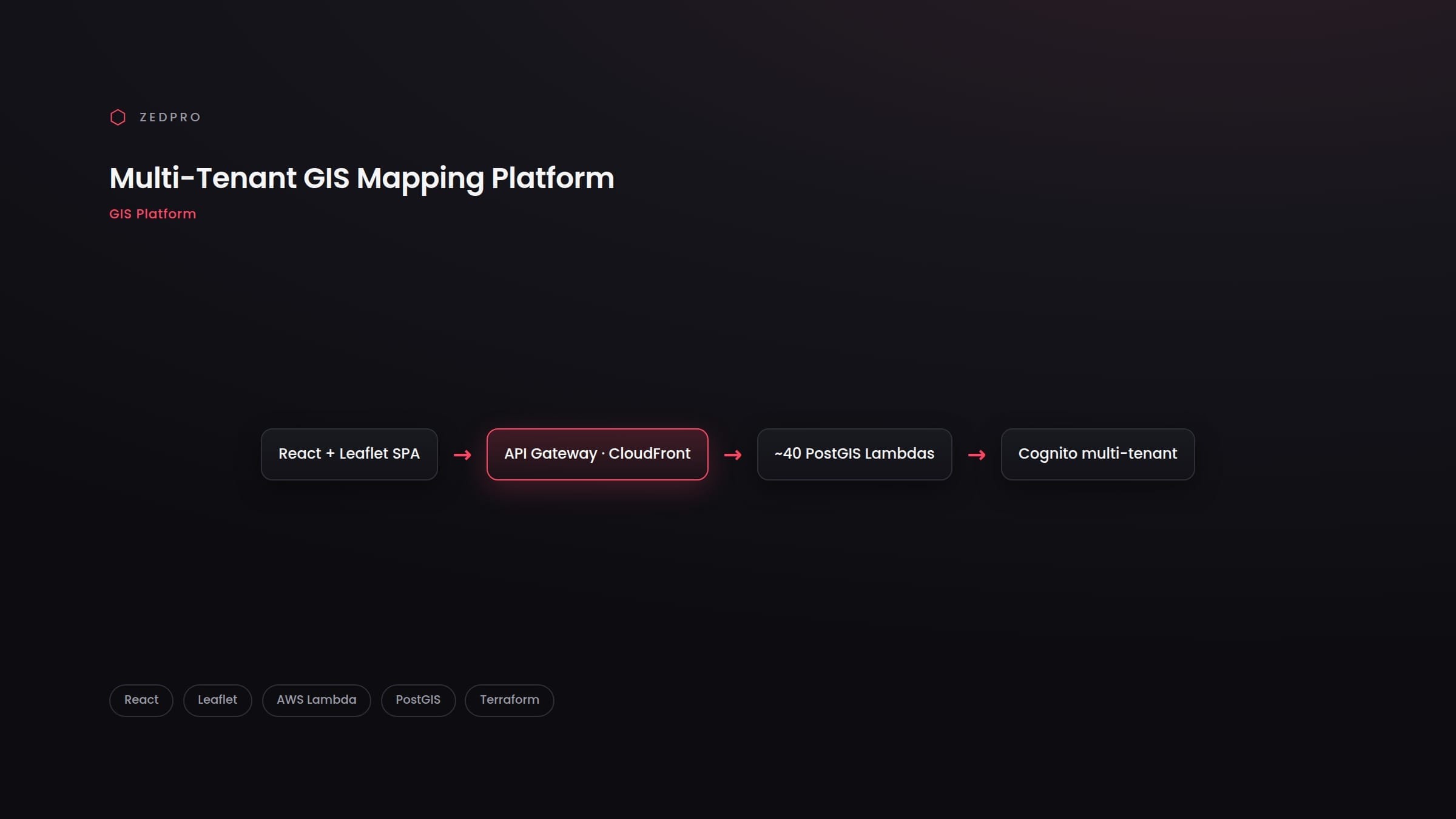
A production, multi-tenant GIS platform for exploring Malaysian property, cadastral and asset data on an interactive map. Built as a white-label product, it pairs a rich Leaflet front-end with a serverless PostGIS backend that serves vector, raster and GeoJSON layers at scale.
Domain
Geospatial / Property
Project Type
Web Application + Cloud Backend
Stack
React · Leaflet · AWS Lambda · PostGIS
Year
2025
What we built
- Interactive Leaflet map with vector (MVT), server-rendered raster and GeoJSON layers across Malaysian states
- Lot-number and radius search, spatial analysis and boundary enrichment
- On-map drawing and digitising with vertex editing, undo/redo and per-layer symbology
- Shapefile / GeoJSON / CSV import and export
- Subscription-based multi-tenancy — roles, quotas, per-layer permissions and audit trails
- ~40 AWS Lambda functions over PostgreSQL/PostGIS, fronted by API Gateway and CloudFront
Related Work
Other Projects
AI Form Extractor for ArcGIS
AI + GIS